Since we undertook the Airwars website redesign in late 2018, we have been collaborating with the civilian casualty watchdog to create feature visualizations, maps and videos.
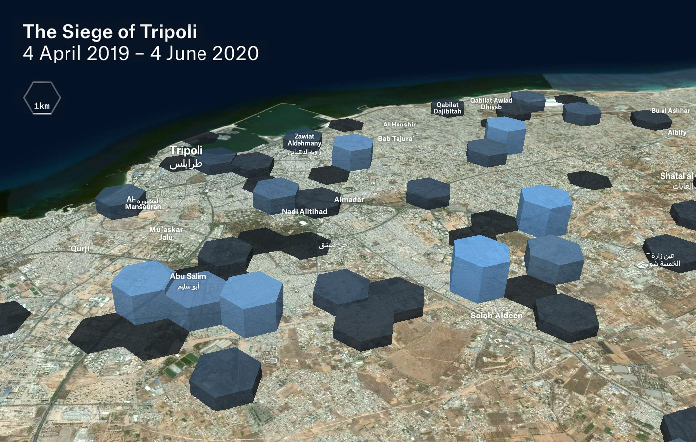
The Siege of Tripoli
As part of an ongoing civil war in Libya, Tripoli was besieged from Spring 2019 to Spring 2020. This interactive visualisation covers these 14 months, displaying reported civilian injuries and deaths.
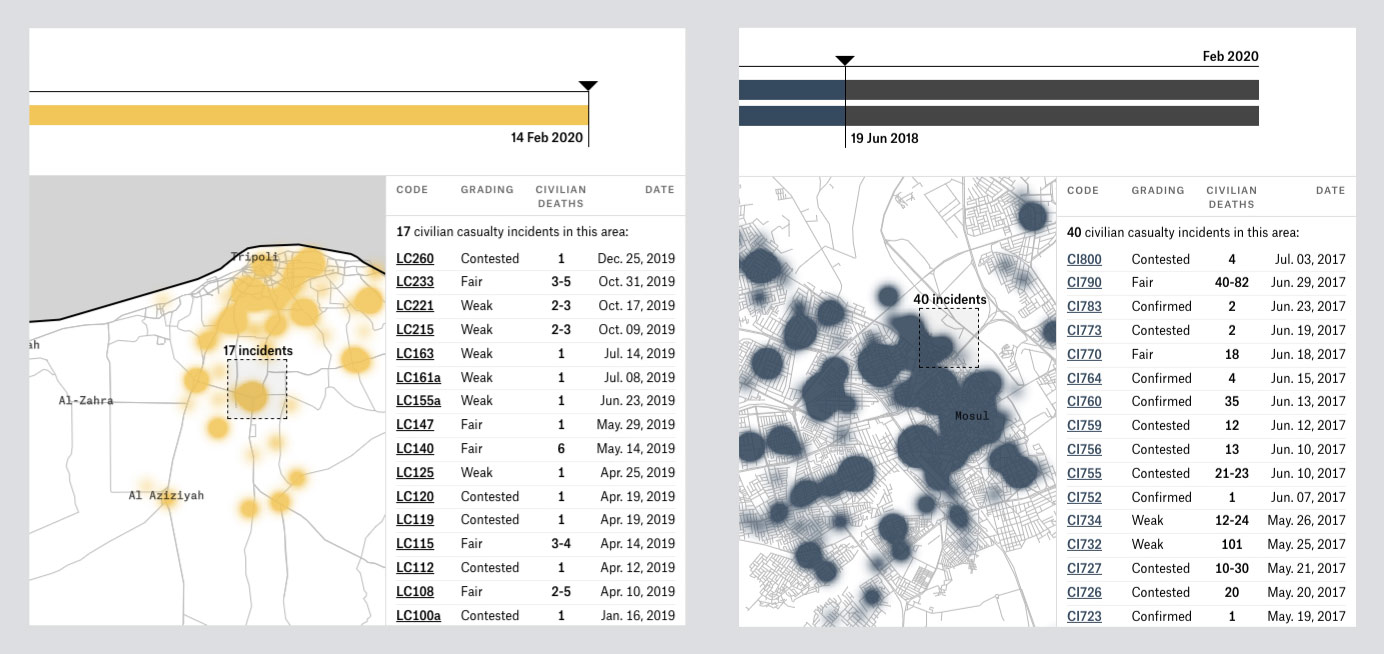
Heatmap Details
Heatmaps are used across the Airwars maps to account for variations in geolocation accuracy.
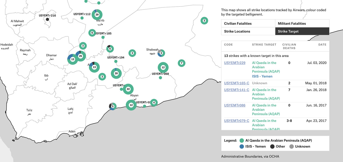
US Forces in Yemen
Some conflicts monitored by Airwars have required more complex mapping, which has involved visualising strike targets, militant fatalities alongside civilian casualties.
Stills from War in Numbers, a video created for Airwars to use for advocacy on social media.
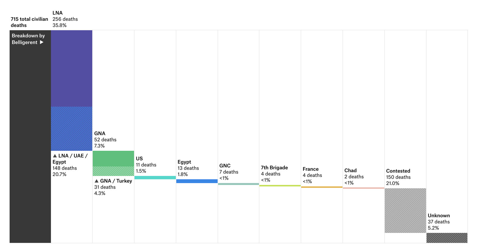
Libya: Civilian Fatalities per Belligerent
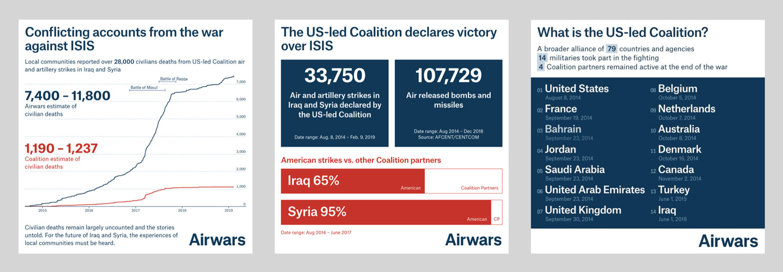
Custom visualisations are developed with the Airwars team to better represent the complexity of conflict.
The Credibles
A visualisation of the close locations of 99% of all officially confirmed or ‘Credible’ civilian harm events by the CJTOIR in Iraq and Syria.